
Official websites use .gov
A .gov website belongs to an official government organization in the United States.
Secure .gov websites use HTTPS
A lock (
) or https:// means you’ve safely connected to the .gov website. Share sensitive information only on official, secure websites.
U.S. Survey Foot: Frequently Asked Questions (FAQs)
Explore the answers to commonly asked questions.
Q. Why is this change being made?
Q. Who has the authority to define units of measure in the United States?
Q. How does such a small discrepancy between unit definitions cause serious problems in surveying and engineering?
Q. What types of errors and costs occur because of this problem?
Q. What are the anticipated benefits of this change?
Q. Why is it important to make this change now?
Q. What actions should stakeholders take to prepare for the upcoming change?
Q. What steps will occur during the deprecation process?
Q. What will happen to the U.S. survey foot after December 31, 2022?
Q. Will the previous U.S. survey foot unit conversion factors be maintained?
Q. How can I learn more about this topic?
Q. Who should I contact if I have additional questions?

Q. Why is this change being made?
A. Discontinuing the use of the U.S. survey foot in surveying, mapping, and engineering is a practical solution to a long-term problem. Ending this will eliminate confusion and unnecessary costs. Improved measurement uniformity and accuracy will benefit stakeholders, including the States and professionals in the surveying, mapping, and engineering fields.
NGS has long used the meter as its official unit of measurement and this will not change. Currently, both the international foot and U.S. survey foot are based on the meter, and in fact all U.S. customary units are based on the International System of Units (SI). Despite this, the U.S. customary system is still used for a wide variety of applications and is often the preferred basis of measurement for commercial activities. As long as this is true, NGS will continue to support the foot as a unit of linear measure ancillary to the meter.
Q. Who has the authority to define units of measure in the United States?
A. Only Congress has the authority to “fix the standard of weights and measures” for the United States, as specified in Article 1, Section 8, Clause 5 of the U.S. Constitution. Congress initially delegated that authority to the U.S. Coast & Geodetic Survey (now NGS) as overseen by the Department of the Treasury. In 1901, the authority was transferred to the National Bureau of Standards (NBS) in the Department of Commerce. In 1988, the NIST Organic Act renamed NBS as the National Institute of Standards and Technology (NIST) and re-established the legal duties of the institution. Congress found that NIST has, since its establishment, served as the Federal focal point in developing measurement standards.
The Secretary of Commerce acting through the NIST Director is authorized by statute (§15 U.S.C. 272) under subsection (2) “to develop, maintain, and retain custody of the national standards of measurement, and provide the means and methods for making measurements consistent with those standards” and under subsection (9) “to assure the compatibility of United States national measurement standards with those of other nations.” Under this authority, the International System of Units (SI) is interpreted or modified by the Director of NIST for use in the United States. Together NIST SP 330 and NIST SP 811 provide the legal interpretation of and guidelines for the use of the SI in the United States. All other measurement units, including U.S. customary units (e.g., feet, pounds, gallons, degree Fahrenheit, etc.), are subsequently defined in terms of the SI.
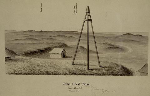
Q. How does such a small discrepancy between unit definitions cause serious problems in surveying and engineering?
A. Although the U.S. survey foot is longer than the international foot by only 2 parts per million (ppm), this small discrepancy accumulates over large distances and can result in significant errors in surveying and civil engineering projects, regardless of the size of the project. For example, when a one-mile distance is surveyed, the difference is approximately 0.01 ft (or 0.12 in). However, the impact becomes substantial when longer distance measurements or conversions are made, such as those involving rectangular plane coordinates of the State Plane Coordinate System (SPCS). In these cases, the difference between the two definitions can also result in large direction and position location errors, in many cases reaching tens of feet for SPCS coordinates. This video explains the difference between the U.S. survey foot (sFT) and the international survey foot (iFT) and the importance of this distinction when working with map projections.
Q. What types of errors and costs occur because of this problem?
A. There has been a long history of misunderstandings and confusion over which definition of the foot was used to carry out a specific land survey or civil engineering project. Most users outside of the surveying profession are unaware that two different definitions of the foot exist in the United States.
There have been many instances where software or electronic surveying devices default to one or the other foot definitions, but users incorrectly assume the actual unit of measure in use. This ongoing ambiguity has resulted in professional liability by the inadvertent violation of State law, the introduction of systematic errors in surveying and engineering projects, misreported position and location, land sale and project delays, boundary disputes, additional costs associated with correcting unit mistakes, and other unintended consequences.
Because State jurisdictions with different legal definitions of the foot share borders, mapping projects in these geographic zones may experience elevated error risks as a surveyor transitions between a State that uses the U.S. survey foot and a State that uses the international foot. This risk is exacerbated when professional surveyors and engineers are licensed to practice in multiple States that use different versions of the foot, and for large projects when the team participants come from different States and even different countries. Making matters worse, some jurisdictions use different types of feet for horizontal and vertical coordinates (elevations), which increases the likelihood for confusion and errors.
The economic impact is not limited only to errors. An additional perpetual cost is due simply to the inefficiency of managing two types of feet. This includes documentation and metadata to keep track of the foot version, a cost that increases with the size, duration, and complexity of projects. Such costs can extend over the entire project life cycle, from planning through contracting, construction, as-built surveys, and even operations.

Q. What are the anticipated benefits of this change?
A. The adoption of a single, uniform definition of the foot will reduce (and eventually eliminate) the cost due to the errors and inefficiencies of having two simultaneous definitions in current use. Going forward this means that when the “foot” is specified, there will no longer be any ambiguity in the definition, regardless of the State where work is performed, or the type of measurements used.
The biggest benefit will be in the use of the State Plane Coordinate System (SPCS) and other large-area projected coordinate systems. Because SPCS zones cover entire States or major portions of States, the coordinate values are large, often exceeding a million feet. A coordinate value of 1,000,000 feet differs by 2 feet if the two versions of the foot are interchanged. This is an unacceptably large discrepancy for nearly all surveying and engineering applications. Having only a single version of the foot available for State Plane after 2022 means that it will no longer be necessary to keep track of which state adopted which foot—all will be the same. This solves a particularly acute problem for States that share a border but use different versions of the foot. Another benefit is that it will eliminate confusion that could occur for States that select their version of the foot at different times or that change the type of foot they want to use (both of these problems occurred for SPCS 83). All SPCS2022 foot definitions will be consistent everywhere and will not change.
Another benefit is in the software and firmware used in surveying and engineering. Such products are developed by people all over the world, whether or not they are used in the United States. Software developers in other countries do not always know about the two foot versions. Going forward after 2022 this will no longer be a problem.
Q. Why is it important to make this change now?
A. Making this change as part of the modernization of the National Spatial Reference System (NSRS) will cause the least disruption to the surveying and engineering professions. That is why it was originally mandated (in 1959) that the use of the U.S. survey foot would end when the geodetic control network of the United States was readjusted, which occurred in 1986 for the change from the North American Datum of 1927 to 1983 (NAD 27 and NAD 83). The idea was simply that such a small change in linear units would be negligible in comparison to all the other changes that occurred at that time (including change of these horizontal datums and their corresponding SPCS 27 and SPCS 83 definitions).
Although the U.S. survey foot was not eliminated in 1986, we now have a second chance to fix this problem when the NSRS is modernized. This again provides an opportunity to absorb the small change in linear unit within the much larger changes that will occur after 2022. These changes include:
- Going from the three geometric reference frames of NAD 83 to four new terrestrial reference frames.
- Switching from a vertical datum based on leveling to a geopotential datum based on a gravimetric geoid model.
- Adopting a new approach to providing geodetic control and performing surveying and mapping that embraces the reality that coordinates change with time.
- Changes in latitude, longitude, and ellipsoid height of about 1 to 3 meters, and changes in orthometric height (elevation) of more than a meter in some locations.
- Changes in State Plane coordinates of at least 10,000 meters in all locations.
- Change in the scale of State Plane coordinates by much more than the 2 ppm difference in the two foot types, in most locations (in some cases changing by hundreds of ppm)
These changes (and others) associated with the 2022 modernization of the NSRS are vastly greater than the change due to eliminating the U.S. survey foot. They are so much greater that any organization or person who can manage such change can most certainly manage a change in the type of foot. To make the change even simpler, NGS will automatically use the correct, single definition of the foot for State Plane and all other components of the NSRS after 2022. There will no longer be any question as to what type of foot is being used.
The cost associated with the NSRS modernization will vary with organizations and individuals, and it will also occur over different time scales depending on when the modernized NSRS is adopted. For some, there will be essentially no cost; they will simply start using the new system as required by projects or agencies. For others the costs could be more substantial, such as for large companies and government agencies that need to transform data or modify established protocols. But in no case should the component of the cost due to elimination of the U.S. survey foot be more than a small fraction of that for overall NSRS modernization.
Q. What actions should stakeholders take to prepare for the upcoming change?
A. The most important way to prepare is simply being aware that the change will occur and maintaining documentation (metadata). Indeed, the lack of metadata (or incorrect metadata) is one of the main reasons the continued use of the U.S. survey foot caused so many problems. Metadata will be especially important in the transition period from the current NSRS to the NSRS after 2022. For example, consider projects in SPCS 83 using U.S. survey feet that are already underway when the 2022 NSRS modernization occurs. In some cases, the most cost-effective and efficient strategy will be to maintain the project in the legacy coordinate system and units. In other cases, it will be better to migrate the entire project to the new system during execution. The most appropriate choice for managing the change will depend on a variety of factors, including the type of project, its size, complexity, duration, and status, as well as the ability, willingness, and preparedness of the organization making (or mandating) the change. But in all cases, the part of the change due to elimination of the U.S. survey foot will be a very small part of the overall change.
It should further be noted that for products and services provided by NGS that much of the change will be handled automatically, including support for legacy systems. For projects where SPCS 83 continues to be used in a U.S. survey foot state, NGS will always provide those coordinates in U.S. survey feet. Similarly, application using SPCS2022 in feet will automatically get coordinates in the only foot defined after 2022 (i.e., 1 foot = 0.304 8 meter exactly). Although NGS has no control over commercial software vendors, it is likely that they will also provide similar automation.
Below are a few more specific recommended actions. These are considered unlikely but are offered for the sake of completeness:
- States should not create legislation that specifies use of the U.S. survey foot for any component of the NSRS after 2022. A template for drafting NSRS legislation has been jointly prepared by the National Society of Professional Surveyors, the American Association for Geodetic Surveying, and NGS. Examples of new state legislation are also available for download. Existing statute or other mechanism (such as FRNs) specifying the U.S. survey foot for SPCS 83 is not a problem, since those will be maintained as legacy definitions based on NAD 83 and thus are not applicable to the NSRS after 2022.
- Businesses and other organizations that have adopted the U.S. survey foot as a “fixed” unit of measure will need to develop a change management strategy to allow for an orderly transition to the new coordinate systems and foot definition. This could apply to internal policy, procedures, workflows, contract templates, specifications, or computational algorithms.
- Commercial software vendors should make certain that their programs explicitly support a foot definition numerically identical to the international foot. This foot definition should be the only one available for computing SPCS2022 coordinates.
- Most (if not all) modern equipment used in surveying is based on the SI system. In the unlikely event that equipment is hard-coded in U.S. survey feet, users should take appropriate action to address the problem. That can include requesting firmware or other updates from the manufacturer (if available). Note however that it is likely that the 2 ppm difference in length will be within the noise of the instrument measurements, especially for older equipment where this problem may occur.
- Surveyors and engineers should make sure that the software they use to perform their work supports the international foot definition. This is probably unnecessary for any modern surveying and software, but it is prudent to check. One way to do this is by checking large standard values used in surveying, such as the semi-major axis of the GRS 80 ellipsoid. It is exactly 6,378,137 m = approximately 20,925,646 international feet = approximately 20,925,604 U.S. survey feet.
Note that in many applications, the difference between the two types of feet is well within the measurement error. A distinction should be made between large coordinate values (such as those used in State Plane) and other linear quantities, such as distance measurements, relative positions on a project site, or distances in a boundary description. For such applications, using the wrong type of foot will usually cause negligible error (the difference is only 0.01 ft per mile). Nonetheless it is good and prudent practice to document the specific type of foot used. Thankfully that will become increasingly irrelevant over time as the U.S. survey foot fades into antiquity.
Elimination of the U.S. survey foot after 2022 will reduce problems with having two versions of the foot in simultaneous use. In contrast, if both foot types were allowed after 2022, the problems (and costs) would never go away. Early on there may be confusion, errors, and costs associated with the change in the foot type, but these will diminish over time. Had this change been made in 1986 as originally intended, it would be only a distant faint memory by now. It further bears repeating that the change in foot type will occur in tandem with the 2022 NSRS modernization, and that it will be a very small part of the other changes happening after 2022.

Q. What steps will occur during the deprecation process?
A. Deprecation is an activity to discontinue the use of a specific measurement unit that has been identified as being redundant or a source of confusion. As the situation with multiple definitions for the foot illustrates, measurement unit uniformity is only possible when a single measurement unit definition is used for a specific application (e.g., land surveying).
The process begins with a notice to users that a unit of measure is to be deprecated and that use of the unit is to be avoided after a specific date (e.g., December 31, 2022). The notice prescribes the new unit of measurement that will be accepted for use. The notice period allows users time to make the necessary changes to their measuring practices, processes, procedures, and devices.
The notice period also provides an opportunity for education and training for all of those involved in the changeover and the identification of unforeseen issues so that appropriate preventive actions, exceptions, or additional requirements can be developed and implemented. After the notice period ends, the deprecated measurement unit is deemed obsolete, its use is to be avoided, and it is retained for historical purposes and legacy applications only.
Q. What will happen to the U.S. survey foot after December 31, 2022?
A. When the notice period ends on December 31, 2022, the deprecated measurement unit known as the U.S. survey foot will be deemed obsolete, its use is to be avoided, and it will be retained for historical purposes and legacy applications only.

Q. Will the previous U.S. survey foot unit conversion factors be maintained?
A. Approximate decimal SI equivalents for measures commonly given in U.S. survey feet and exact equivalents for the foot that will be adopted after December 31, 2022 will be published near to this date and maintained in NIST SP 811, The NIST Guide for the use of the International System of Units. Review the proposed unit conversion factors now. Exact ratio definitions of the SI equivalents to the U.S. survey foot will also be maintained. After 2022, the unit previously known as the international survey foot will simply be called the foot.
In addition, NGS will support the U.S. survey foot for legacy applications. For example, NGS software will always provide coordinates in U.S. survey feet for all SPCS 27 zones, and it will provide the appropriate type of foot for SPCS 83 zones based on the State where the zone occurs. A list of states with the type of foot used for SPCS 83 (if any is specified) is given in Appendix C of NOAA Special Publication NOS NGS 13.
Q. How can I learn more about this topic?
A. The measurement unit change background and solutions to the problem of having two version of the foot in current use are described in two NGS webinars. The first is Fate of the U.S. Survey Foot after 2022: A Conversation with NGS given on April 25, 2019. The second is Putting the Best “Foot” Forward: Ending the Era of the U.S. Survey Foot (1959 to 2022) scheduled for December 12, 2019.
NGS webinar videos and slides are available to view or download through the Recorded Webinars page.
Q. Who should I contact if I have additional questions?
A. For information on standards development and maintenance of the U.S. survey foot, please contact Elizabeth Benham (301-975-3690, Elizabeth.Benham [at] nist.gov (Elizabeth[dot]Benham[at]nist[dot]gov)). For technical and historical information on usage of the foot, please contact Michael Dennis (240-533-9611, Michael.Dennis [at] noaa.gov (Michael[dot]Dennis[at]noaa[dot]gov)).