
Official websites use .gov
A .gov website belongs to an official government organization in the United States.
Secure .gov websites use HTTPS
A lock (
) or https:// means you’ve safely connected to the .gov website. Share sensitive information only on official, secure websites.
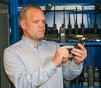
Dereck Orr with a variety of radios and cell phones used in NIST's public safety communications research. A new NIST report outlines research needed on location-based services—applications such as GPS that can improve situational awareness for emergency responders.
The National Institute of Standards and Technology (NIST) has published the first "roadmap" for the next 20 years of research needed to establish seamless, broadband public safety communications networks across the United States. The new roadmap, the first of a planned series on relevant technologies, focuses on location-based services to improve situational awareness for police, firefighters, emergency medical services and other first responders.
The roadmap was commissioned by NIST's Public Safety Communications Research (PSCR) program, which has been performing research, development, testing and evaluation, and creating standards to support first responder communications since 2002.
"The roadmap will guide planning for public safety communications research, including how to allocate the $300 million apportioned to NIST from the recent AWS-3 spectrum auction," said Dereck Orr, chief of the PSCR Division of NIST's new Communications Technology Laboratory.
One of the PSCR's goals is to enable broadband public safety data, video and voice communications across different agencies and jurisdictions. To that end, the PSCR operates a 700-MHz public safety broadband demonstration network and provides technical advocacy by gathering requirements and developing standards.
The new roadmap offers a vision of what public safety communications might look like in 20 years. It identifies software, device and network R&D investments needed to achieve that vision. The roadmap points out opportunities for action by multiple stakeholders, including federal, state and local governments; academia; industry; and the public safety community. The document is based on ideas captured during a 2013 workshop involving 150 participants from both the public and private sectors.
A number of technology trends potentially affect public safety communications, according to the report. Advances in wearable technologies and public safety applications for them are expected in 5 to 10 years, and convergence with the Internet of Things and full integration into public safety use is foreseen in 10 to 20 years. The current reliance on voice communications for public safety is expected to give way to primarily data communications in some environments in 10 to 20 years.
"Location-based services" encompass applications that use information about the physical location of a user based on, for example, GPS signals. Location-based services were chosen as the first roadmap focus area because enhancements are feasible and could have high impact and return on investment, for example, by enabling more efficient allocation of personnel and equipment.
According to the roadmap, location-based services are already useful for public safety purposes in places with adequate network coverage such as outdoors in cities. Location services, including elevation data (e.g., which floor of a building personnel are on), are expected to become more widely available indoors, underground and in rural and extreme geographical settings in 5 to 10 years and ubiquitous in 10 to 20+ years, along with enhanced precision and analytics. A key software need is improved 3D visualization and mapping. Opportunities include potential collaborations with the "smart home" R&D community.
The report identifies significant needs for location-based standards; in particular, open standards that provide for data exchange and availability among different devices and systems. The United States does not have indoor position standards. Achieving consensus and buy-in on such standards is critical and requires significant effort, the report notes.
While voice, video and data are already integrated in commercial handheld devices, the public safety community has yet to leverage the full scope of potential integrated services, including voice over IP (Internet Protocol), digital video broadcasting and the Internet of Things. The report identifies needs for public safety performance metrics, including accuracy, speed, power and availability, as well as testing for integrated devices. Among other technology R&D needs, the report calls for finding ways to minimize the battery consumption of location-based services systems, which tend to be power drains. In addition, because public safety communications must cover all geographical areas, ad hoc networks—portable systems that can be set up quickly to meet immediate needs—could be developed to bring the technology to events.
The Location-Based Services R&D Roadmap 2015 (NIST Technical Note 1883), can be found on the NIST website (or via http://dx.doi.org/10.6028/NIST.TN.1883). The PSCR plans to develop additional roadmaps in other technology focus areas, including analytics and user interface and experience.
As a non-regulatory agency of the Commerce Department, NIST promotes U.S. innovation and industrial competitiveness by advancing measurement science, standards and technology in ways that enhance economic security and improve our quality of life. To learn more about NIST, visit www.nist.gov.